 This is an example offering which would allow your customers to schedule a time to meet with you. Offerings automate customer interactions online by allowing them to schedule a service/appointment, pay for a lesson, purchase tickets/vouchers, request a quote, all with online payments. You can create as many as you like with pictures, descriptions, price options, and even questionnaires.
S5PSM Day Paddles and Overnight Trips
Panacea/St. Marks Area
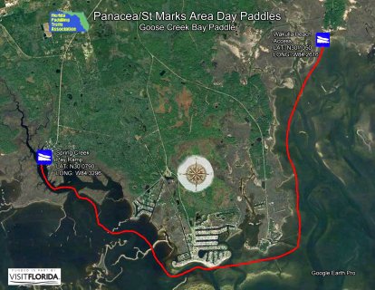
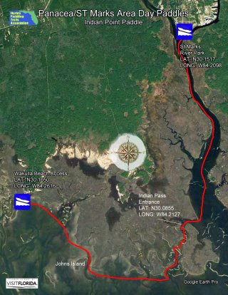
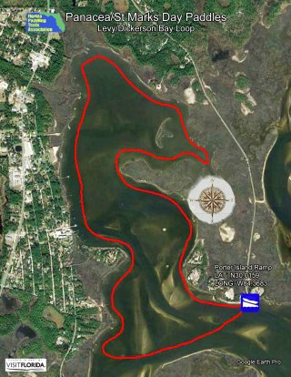
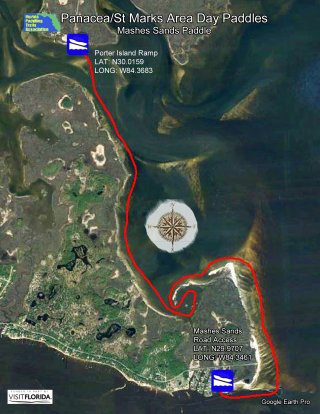
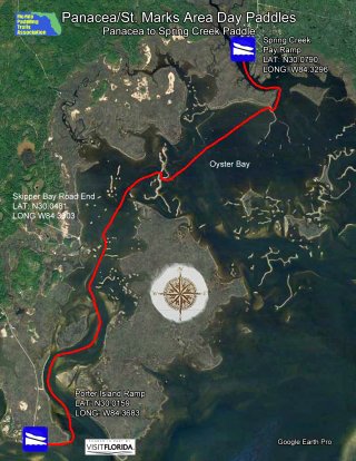
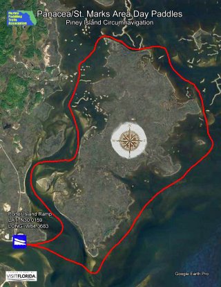
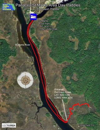
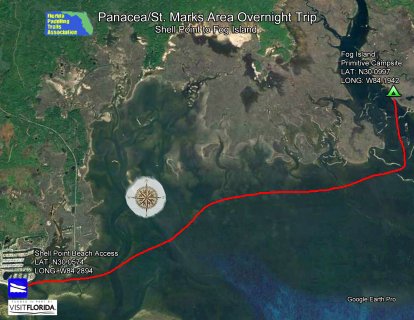
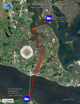
All maps are printable in an 8.5 X 11" format. To print out maps in full size, please download them first to your computer before printing. For more information on mentioned boat ramps and paddle launches, please see Launch Sites and click on the icons for additional details.
Area Overview Area Map
Area Map 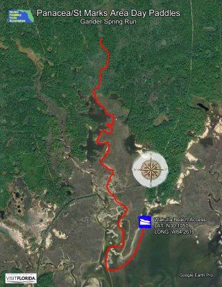

Documents Attached to S5PSM Day Paddles and Overnight Trips:
